Target: use title, orientation, key, scale and cell references to describe a spatial pattern accurately. Prepare: Card A and grid reader.
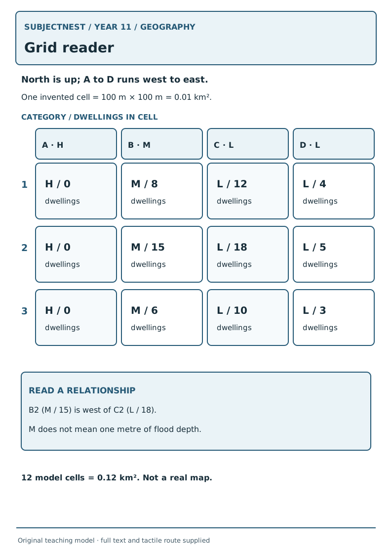
- Launch · 2 min. Point to B2. Ask whether it is west or east of C2 and whether the label is a measured depth.
- Model · 4 min. North is up; A→D runs west→east; row 1→3 north→south. B2 is M, immediately west of C2. One cell is 100 m by 100 m, so 0.01 km²; the 12-cell rectangle represents 0.12 km² in this model.
- Guided reading · 5 min. Students locate A3, C1 and D2 by coordinate; read the letter category and counted dwellings separately. Say “M cells form a north–south band” rather than “all of town floods.”
- Practice route · 7 min. Choose Day 3 route. Describe A's west–east category change with two cell references and one scale/legend caveat.
- Audit · 4 min. Partner reverses north/south or calls M “one metre”; learner uses the key to correct both.
- Exit · 3 min. “What is the area of one 100 m square cell?” Key: 10,000 m² = 0.01 km²; this does not create a real map scale.